On this sheet / 7 parts
The cheapest way to understand the Bridgewater Canal is to follow the coal. In the 1750s Francis Egerton, 3rd Duke of Bridgewater, had mines at Worsley, a few miles west of Manchester, and a market in the town that he could reach only by bad roads or by paying tolls on the Mersey and Irwell Navigation. His solution was a private waterway that ran straight from the pit to the customer.
The duke, Brindley and Gilbert
Three men made it. The duke supplied the money and the stubbornness. John Gilbert, his estate manager, knew the ground and the mines. James Brindley became the principal engineer and argued for the bold version of the plan: instead of locking down to the River Irwell and back up again, the canal would stay on one level and cross the river on an aqueduct at Barton, then run on through Stretford to Manchester.
Parliament had to approve it, and did so more than once. The first act received royal assent on 23 March 1759 and was superseded by a second, with assent on 24 March 1760, once the route over the Irwell was settled. A further act of 24 March 1762 authorised the extension towards the Mersey.
The first boat crossed the Barton Aqueduct on 17 July 1761. That date is the one to remember, because it marks the opening of the section from Worsley towards Manchester.
Coal under the hills at Worsley
The canal did not simply start at the mines. It went into them. At Worsley the boats entered tunnels cut into the hillside from the Delph, an old sandstone quarry that became the entrance to what were called the Navigable Levels. Over the following decades these underground canals grew to about 46 miles on four levels, linked by inclined planes, so that coal could be loaded at the face and floated out.
Coal production there stopped in 1887. The Delph is now a scheduled monument, and the tunnel entrances can still be seen from the canal side in Worsley village, though the levels themselves are closed.
Price of coal halved in Manchester
Within a year of the 1761 opening the price of coal in Manchester had roughly halved. That one figure explains why the Bridgewater Canal matters to the history of the city rather than only to the history of engineering. Cheap coal meant cheap steam, and steam meant cotton could be spun in town mills instead of in water-powered mills on Pennine streams.
The canal stayed a private business. For the mill owners it was a utility; for the duke it was an asset that kept paying.
Castlefield basin and the canal network
The Manchester terminus was at Castlefield, beside the River Medlock, with a warehouse where boats unloaded. Over the next seventy years the basin filled with warehouses, among them the Merchants' Warehouse, built on the north bank at the entrance to the Giant's Basin around 1827. The link down to the Mersey and Irwell Navigation through the Hulme Locks was not completed until 1838.
Castlefield became a junction rather than an end point when the Rochdale Canal arrived in 1804. That canal runs 32 miles over the Pennines from Castlefield and was built with 92 locks. Its Manchester stretch passed the Ancoats mills and met the Ashton Canal above lock 84, so cargoes from the Pennine route and from Worsley could meet in one basin. The Rochdale Canal was reopened for navigation along its entire length on 1 July 2002, and its route beneath Piccadilly is described on the page about Manchester's underground tunnels.
Meanwhile the duke pushed his own canal west to the Mersey at Runcorn. The extension opened in stages from 1767, reached the Mersey on 1 January 1773 through a flight of ten locks that has since been removed, and was finished by March 1776. The whole Bridgewater Canal is 41 miles long.
From stone aqueduct to swing aqueduct
Brindley's Barton Aqueduct was a masonry bridge that carried boats over the Irwell. It lasted until 1893, when the Manchester Ship Canal was dug along the line of the Irwell and a fixed stone aqueduct would have blocked ocean-going ships.
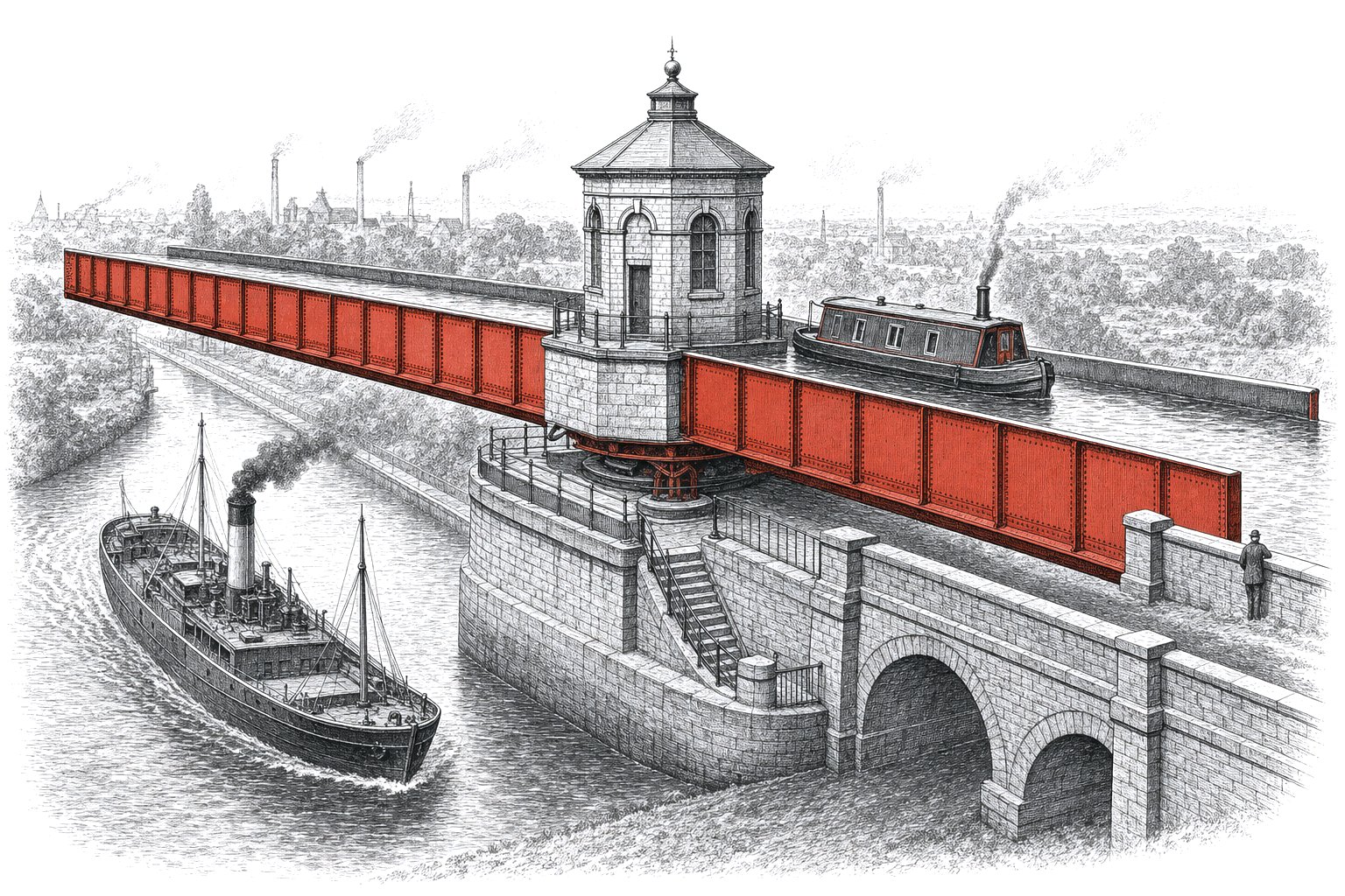
Its replacement is stranger. Sir Edward Leader Williams, engineer to the Ship Canal company, designed an iron trough 330 feet long that sits on a pivot on a small central island and swings through 90 degrees. Gates at each end close before it turns, holding about 800 tonnes of water inside. The trough itself weighs 1,450 tonnes, and the race plate it turns on is 27 feet across. Andrew Handyside and Company of Derby built it. The first barge crossed on 21 August 1893, and it opened to commercial traffic on 1 January 1894.
| Structure | Date | Key figures |
|---|---|---|
| Barton Aqueduct (Brindley) | first boat 17 July 1761; demolished 1893 | masonry, over the River Irwell |
| Worsley Navigable Levels | worked until 1887 | about 46 miles underground, four levels |
| Runcorn extension | 1767-1776 | ten locks to the Mersey, opened to it 1 January 1773 |
| Rochdale Canal junction | 1804 | 32 miles, 92 locks as built |
| Hulme Locks link | 1838 | to the Mersey and Irwell Navigation |
| Barton Swing Aqueduct | opened 1 January 1894 | 330 ft trough, 1,450 tonnes, 800 tonnes of water |
The swing aqueduct was listed Grade II* on 29 June 1987. It still works, and seeing it turn is worth the trip to Barton if you can catch it.
The Ship Canal and what came after
The Manchester Ship Canal made Manchester a port and changed the Bridgewater's job. Today the two connect by a lock at Cornbrook. The ship canal also ran past the estate that became Trafford Park, the industrial estate described on the industrial Manchester hub, and brought cargo straight to the doors of firms such as Metropolitan-Vickers.
Eventually the Ship Canal Company owned both the Bridgewater and the Rochdale canals, and with competition gone the short Manchester and Salford Junction Canal of 1839 was abandoned in 1922.
Walking the Bridgewater Canal today
A good half-day walk starts at Castlefield Basin, where you can still see the canal arm, the warehouses and the railway viaducts that came later. A few minutes away on Liverpool Road stands the terminus of the 1830 railway, covered on the page about Liverpool Road station. Follow the towpath west through Stretford to Barton and watch the swing aqueduct from the road bridge alongside it.
From Barton the towpath continues to Worsley, where the Delph marks the start of everything. For what the coal was burned in once it reached the mills, read about the Lancashire boiler and the coal seams on Manchester's coalfields.