On this sheet / 6 parts
The stadium and velodrome in east Manchester stand on a colliery. Bradford Colliery, about two miles east of the city centre, was still raising more than half a million tons of coal a year when it closed in 1968, and few things show better how close the Manchester coalfield came to the city it fuelled.
The geology under the Irwell
The Manchester coalfield is the eastern end of the South Lancashire Coalfield. Its coal formed in the Carboniferous period and lies in the Coal Measures, a sequence of sandstones, mudstones, shales and fireclays laid over the older Millstone Grit. The seams that paid lie in the lower two-thirds of the Middle Coal Measures, between the Worsley Four Foot mine near the top and the Arley mine near the bottom. Miners called a seam a mine, so the names on old plans read like a list of pits when they are really layers.
Faulting decides almost everything. The Pendleton Fault runs along the Irwell valley, and the measures generally dip to the south and west, so a seam that outcrops in the valley lies far deeper a few miles to the south-west. East of the fault, under Bradford and Ardwick, sits a separate block that has more in common with the Oldham field than with Worsley: the Bradford Group of seams, then the Top, Middle and Deep mines, then the deep, high-quality Roger mine.
In the west the main seams include the Worsley Four Foot, Crombouke, Brassey, Rams, Black and White, Doe, Five Quarters, Trencherbone, Cannel, Plodder, Yard, Three Quarters and Arley. Two of those names come back below, because the 1910 explosion happened in the Plodder and Agecroft's rebuilt shafts reached the Trencherbone.
From bell pits to the Bridgewater levels
Easily reached seams were dug on a small scale from the Middle Ages, through adits and bell pits on the outcrop of the Worsley Four Foot in the Irwell valley and around Atherton. The first drainage sough at Worsley was cut in 1729. Real expansion came with the third Duke of Bridgewater, whose Act of 1759 led to the Bridgewater Canal, completed in 1764, running from the mine entrance at Worsley Delph towards Manchester.
Underground, the Duke's engineers kept tunnelling. The main navigable level ran about 4 miles, an upper level of 1773 added another 1.75 miles, and two more were cut 57 and 83 yards below the main one. By 1887 the Worsley Navigable Levels totalled 46 miles of underground canal. They stopped carrying coal in that year and were used for drainage until 1968.
The deep collieries
Pendleton, on Whit Lane in Salford, shows how fast the industry went down once steam pumping was available. John Fitzgerald started sinking in the late 1820s with Robert Stephenson, George Stephenson's brother, supervising. The shaft struck coal at 1,392 ft in 1840. In 1836 the colliery supplied at least 215,000 tons, about 24 per cent of Manchester's coal. When its workings reached 3,600 ft it was described as the deepest coal mine in the country, with the coal face at 100°F. It closed in 1939 when the Rams mine was worked out.
Bradford is the one inside the city. Records start in 1740 and the first deep shaft went down in 1840. By 1856 two 18 ft shafts had reached the Parker mine, the local name for the Worsley Four Foot, at 540 yards. Deepening to the Deep mine at 902 yards began in 1903 and reached coal in 1906; the Parker shaft was taken to 955 yards in 1944-1948. Reserves were estimated at about 310 million tons. The pit closed anyway, in 1968, because subsidence under the surrounding streets had become too expensive. The 17-acre site was cleared, its two shafts capped with reinforced concrete, and part of it now lies under the City of Manchester Stadium.
Agecroft had two lives. Andrew Knowles and Sons sank the first shafts in 1844; Nos. 3 and 4 were deepened to the Trencherbone between 1894 and 1900; the pit closed in 1932 apart from pumping. The National Coal Board then spent £9 million rebuilding it around a new No. 5 shaft 2,000 ft deep and 24 ft across, with first coal wound in August 1960. Its main customer was Agecroft power station, fed by conveyor across Agecroft Road. The colliery closed in March 1991.
Clifton Hall and the Pretoria Pit
Clifton Hall Colliery, off Lumns Lane in the Irwell valley, was working by 1820. At about 09:20 on 18 June 1885 firedamp that had gathered in part of the workings was ignited by a candle, and coal dust is thought to have spread the blast. The official report listed 177 deaths; the memorial gives about 178. The pit stopped producing coal on 9 November 1929.
Twenty-five years later came the worst. On 21 December 1910 an explosion in the Plodder mine at the Hulton Colliery Company's Bank Pit No. 3, the Pretoria Pit at Over Hulton near Westhoughton, killed 344 men and boys. It followed a roof fall the previous day that is thought to have let gas accumulate. The Grade II listed memorial in Westhoughton cemetery dates from 1910 and an annual service is still held there; a statue by Jane Robbins was unveiled opposite Westhoughton church on 19 December 2010.
The collieries at a glance
| Colliery | Place | Opened | Closed | Notes |
|---|---|---|---|---|
| Worsley mines | Worsley | first sough 1729 | coal carriage ended 1887 | 46 miles of navigable levels, drainage until 1968 |
| Bradford | Bradford, Manchester | records from 1740 | 1968 | Deep mine at 902 yards, site partly under the City of Manchester Stadium |
| Clifton Hall | Clifton, Salford | working by 1820 | 1929 | Explosion of 18 June 1885, about 178 killed |
| Pendleton | Whit Lane, Pendleton | late 1820s | 1939 | Workings to 3,600 ft, coal face at 100°F |
| Agecroft | Pendlebury, Salford | 1844 | 1991 | Rebuilt by the NCB, first coal from No. 5 shaft in 1960 |
| Astley Green | Astley, near Tyldesley | sinking began 1908 | 1970 | 1912 headgear and winding engine survive |
Astley Green and how to see it
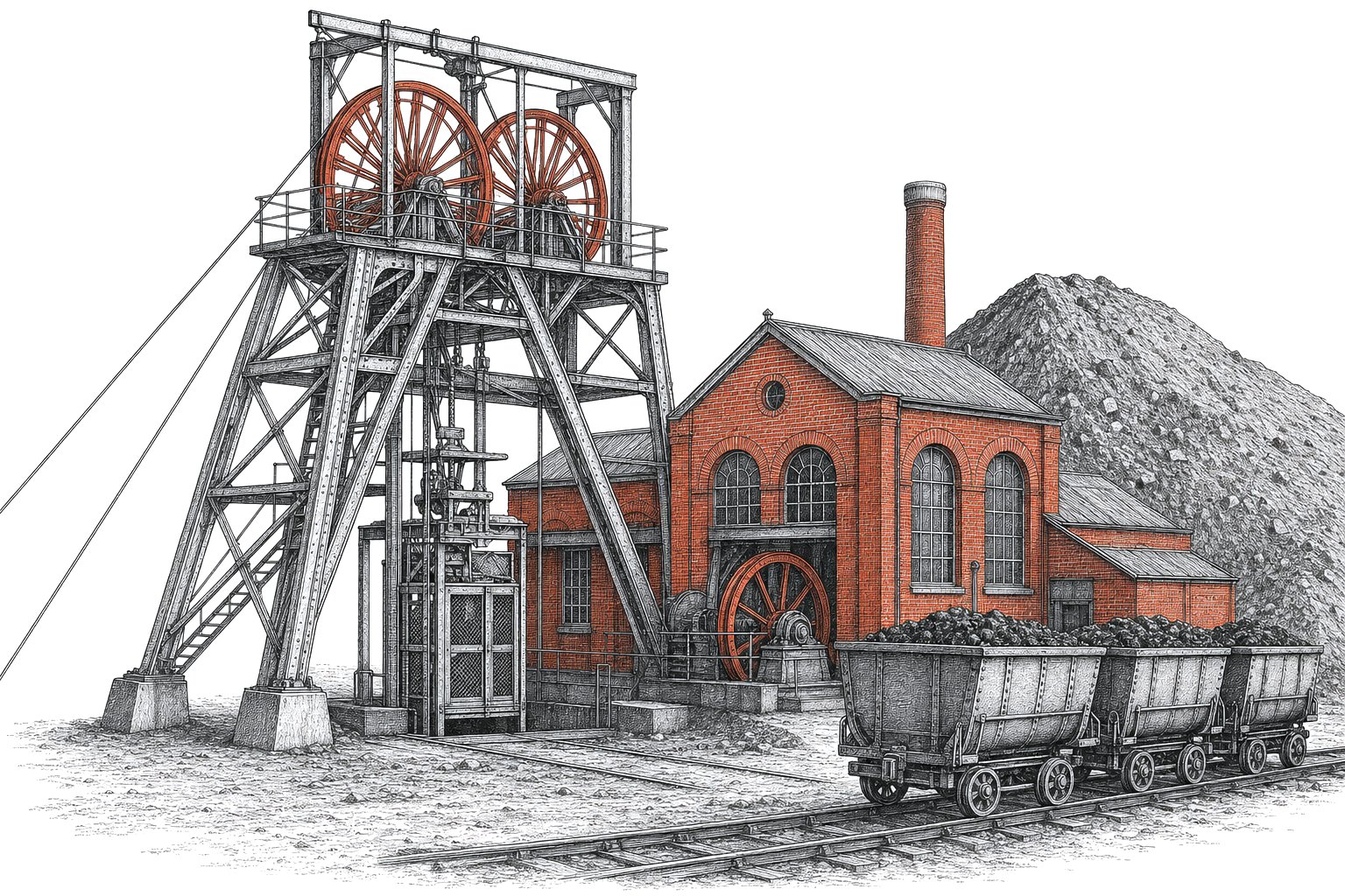
Only one pit top of the Lancashire coalfield survives intact enough to show what a working colliery looked like, and it is at Astley Green, near Tyldesley. The Pilkington Colliery Company, part of the Clifton and Kersley Coal Company, began sinking in 1908. No. 1 pit went to 890 yards. Its lattice steel headgear, nearly 30 metres high, was finished by 1912, and the same year a 3,300 hp twin tandem compound winding engine by Yates and Thom of Blackburn was installed in the engine house beside it. The colliery closed in 1970.
The headgear, the concrete thrust pillar that braces it and the winding engine in its original house are a scheduled monument, and the winding house and tower are also listed Grade II. The site is open as the Lancashire Mining Museum. When you go, look at the size of the engine against the house built round it: the drum it turned had to wind cages up a shaft more than half a mile deep. Historic England has noted that the headgear needs significant investment, so check the museum's own notices before planning a visit around the winding engine running.
The coal raised from the Manchester coalfields went into the boilers of the cotton mills, the city gasworks and, last of all, the power stations. For how that fuel changed the way mills were driven, see water power to steam power; for the rest of the supply story, the energy section. Anyone researching a mining ancestor in the Manchester coalfields should know that in 1929 the independent owners, Andrew Knowles and Sons among them, combined as Manchester Collieries, so a pit can appear under either name depending on the date.